



As the lifeline of Assam, the Brahmaputra River is both a boon and a bane; it fertilizes and enriches the soil on one hand yet causes destructive monsoon floods on the other. Assam receives both the monsoon rains and water from glacial melts from its northern tributaries originating in the Himalaya. The glacial melt in summer coincides with the monsoon, intensifying downstream flow, causing the annual flooding.
The River is so vast that NASA astronauts aboard the International Space Station (ISS) have frequently photographed it because of its immense scale and unique structure of a braided river. A braided river is a network of multiple shallow channels that continuously split and rejoin around temporary sediment islands called braid bars that makes them suitable to be photographed from a satellite due to the Sunglint phenomenon. Sunglint is an optical phenomenon that occurs when sunlight reflects off the surface of water at the exact same angle that a satellite sensor is viewing it.
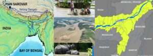
Origin: The Brahmaputra River originates in Tibet near Lake Mansarovar as the Yarlung Tsangpo (Tsangpo means river in Tibetan) and flows eastwards. It takes a U-turn around the Namcha Barwa peak and enters Arunachal Pradesh as the Dihang River, which is joined by the Dibang and Lohit rivers before it enters Assam as the mighty Brahmaputra. After flowing ~650 km through Assam, it takes a southward turn to enter Bangladesh, where it is called the Jamuna River. Finally, it joins with the tributaries of Ganga to enter the Bay of Bengal.
A few of the major causes that lead to annual floods in Assam are listed.
Size: The Brahmaputra River ranks among the top 10 largest rivers in the world in terms of water volume with ~19800 cubic metres/sec water discharge. Flowing through the cold, arid, and barren landscape of Tibet, the Brahmaputra River is fed by melting glaciers that erode rocks and transport loose soil. Along with its upstream tributaries, the river accumulates an enormous sediment load averaging 1,000 tonnes of silt per square km, making it one of the most sediment-heavy rivers in the world. The shrinking channel volume due to heavy siltation cannot contain the massive water flow during monsoon, leading to the river overflowing its banks.
Landscape: The topography of the Assam Valley is surrounded by hills on almost all sides. Water from its northern tributaries in the Himalaya flows down steep slopes at high velocity before joining the Brahmaputra River. However, a problem arises when these tributaries transition abruptly from hills to plains, causing their slope and water velocity to decrease dramatically. As we understand from simple physics, fluid velocity diminishes as the gradient decreases. Consequently, as the water flow slows, tributaries deposit their silt because they no longer have the force to carry it farther. This high sediment deposition raises the riverbed and reduces the river’s volume. As a result, heavy rainfall in upstream catchment areas like Bhutan or Arunachal Pradesh can cause severe floods in Assam, even during local dry spells, because raised riverbeds force the overflowing water over the banks.
Rainfall: The Assam Valley receives an average annual rainfall of approximately 170 cm, peaking during the monsoon season. Combined with upstream flows, this intense local rainfall overfills the Brahmaputra and its tributaries, leading to severe flooding.
Earthquakes: Northeast India is one of the most earthquake-prone regions in the world. Four earthquakes of magnitude greater than 8 have occurred in the last 130 years. The Great 1950 Assam earthquake brought several changes in the Brahmaputra River basin like natural landslide dams and raised river beds at several places, blocking major river tributaries. The landscape, choked with debris, uprooted trees, and silted riverbeds, has permanently modified local topography and river courses, leading to overflowing of the Brahmaputra River in monsoon.
Erosion: The high velocity of water in the Brahmaputra during monsoon erodes the banks continuously, resulting in changes of the river course. This completely washes away some areas and creates new banks and riverine islands every year. This happens regularly and the people in the close vicinity of the river are seriously impacted.
Manmade reasons: Several anthropogenic activities contribute to flooding in Assam during monsoon, most notably are floodplain deforestation, human encroachment, wetland loss, and poorly implemented flood-control measures.
Can Brahmaputra be tamed? Having worked in Northeast India for a long time, I believe that instead of trying to tame a river that spans 14 km wide in some braided channels and carries a heavy sediment load, it is a very difficult task. Rather than trying to tame the river, we must learn to coexist with it by combining structural engineering with ecological strategies to manage its flow and mitigate flood hazard.
Strategies to minimise flooding: The experience so far has shown that relying entirely on traditional embankments is ineffective due to the heavy sediment load and shifting nature of the river. A few of the technical solutions are suggested: i) River dredging to excavate accumulated sediments from the river bed, ii) Installing permeable concrete porcupine screens and geosynthetic bags to trap silt, protect riverbanks, and reduce erosion, iii) Strengthening selected embankments to protect towns and important agricultural areas, iv) Creating wetland diversion channels to divert excess floodwaters into large, natural low-lying wetlands and designated detention basins, v) Constructing community shelters on raised platforms in rural floodplains for people and livestock to safely evacuate during monsoons.
The government should also think of some policy solutions like, i) River basin governance on a unified basin-wide scale, ii) Enacting spatial planning laws to ban permanent commercial developments and illegal construction on active floodplains, iii) Massive tree-planting drives across the upper catchment areas in Arunachal Pradesh and Meghalaya to reduce soil run-off and slow the water velocity and iv) Intelligently linking tributaries on the north bank that carry massive, flashy floods with southern tributaries to equalize water pressure across the Assam valley.
Final word: Natural phenomena, such as floods, droughts, earthquakes, tsunamis, cyclones, landslides, volcanoes, wildfires, and cloudbursts are physical hazards that have occurred on Earth since its formation. So are the floods caused by the Brahmaputra River in Assam. It finds its mention in Puranas, specifically in the Kalika Purana and Yogini Tantra, as well as in the Mahabharata under its ancient Sanskrit name, Lauhitya. Later, the Ahoms, Mughals and the British have written rich accounts of their travels as they encountered the Assam floods.
Due to population growth over the past century, more people are now settling near riverbanks. Consequently, a greater number of people, livestock, crops, and wild animals face higher risks from annual floods. Since this scenario is not going to change, it would be sensible to develop effective responses to flood hazard by restoring forests and wetlands, controlling hill cutting and encroachment, maintaining embankments, regulating mining activities including sand mining, improving drainage, and developing early-warning systems.
Today, we live in a world where development is not a choice; it is a human necessity, and blaming humanity for building the future ignores the very instinct that allowed us to survive. The evolutionary history tells us that “Extinction is the rule, survival is the exception”. So, let us survive with best practices and stop regarding our land as a commodity belonging to us. Instead, let us see our land as a community to which we belong. This change in outlook may lead to a change in our approach and we may begin to see and treat our land with love and respect for our survival.


Difficult natural phenomena to be handled. Well articulated and analysed with pros and cons.👍
Given the Brahmaputra’s exceptionally high sediment load and dynamic braided morphology, how significant is sediment aggradation in reducing the river’s effective carrying capacity compared with increased discharge from monsoon rainfall and glacial melt, and which of these is actually the dominant driver of recurrent flooding?
Very thoughtful article of recent happening around Bhramaputra river. A well written document for IAS interview. Great wusing you to write many more lucid articles on geography and natural calamities
Nice article, worth knowing its historical facts, difficult land topography, as mentioned it is a boon and bane as well to the people of the river course. Very nicely written its pros and cons. It is a well established fact that the author can write on any subject, keeping in mind the national importance in particular.
A very informative article on Brahmaputra river and the annual floods in Assam. Even though the floods are repeated as an annual ritual very little is done to control the loss of property and or human lives. It may be partially due to the size of the river as mentioned in the article but the willingness to tackle the issue simply doesn’t exist with government agencies starting from independence no political party showed any interest in tackling the issue. I was talking to my friend Ranjoo in Assam, as per him this year floods are more severe and more water entered the villages and towns submerged houses for long duration than any previous year. The RRL geoscience building is still under 3 – 4 feet of water. The illegal digging of earth stone quarries in uncontrolled manner contributed more towards this year floods. My prayers go to the people who suffered a lot and endured difficult conditions without electricity, drinking water and food.